


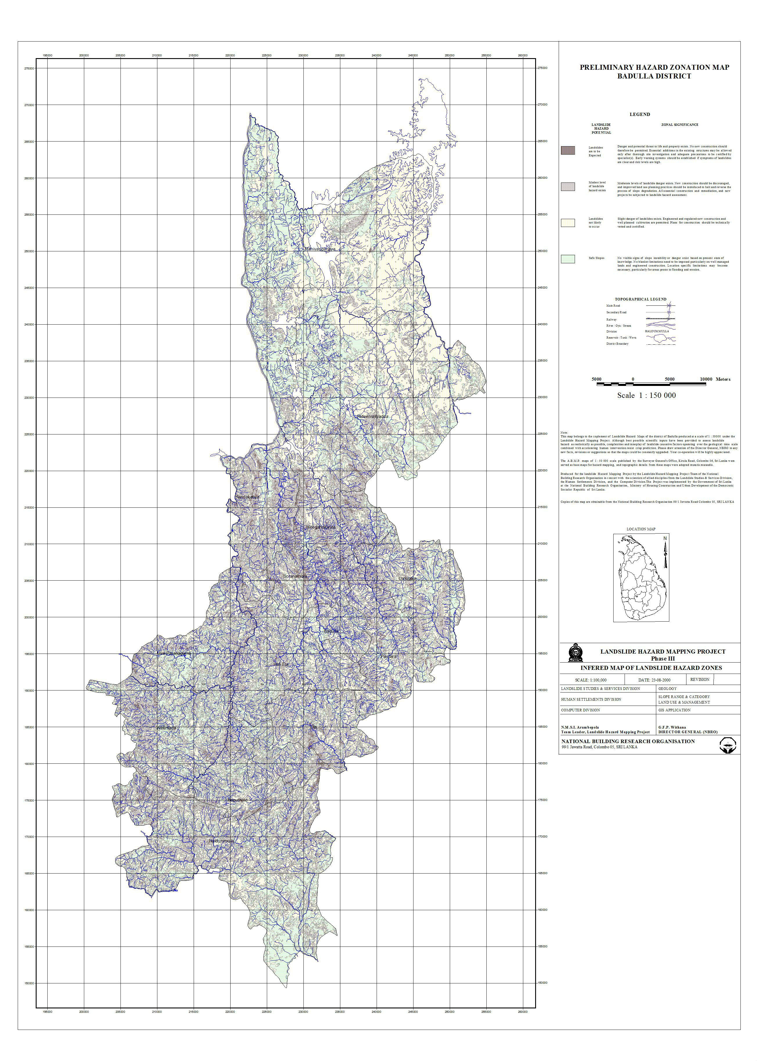
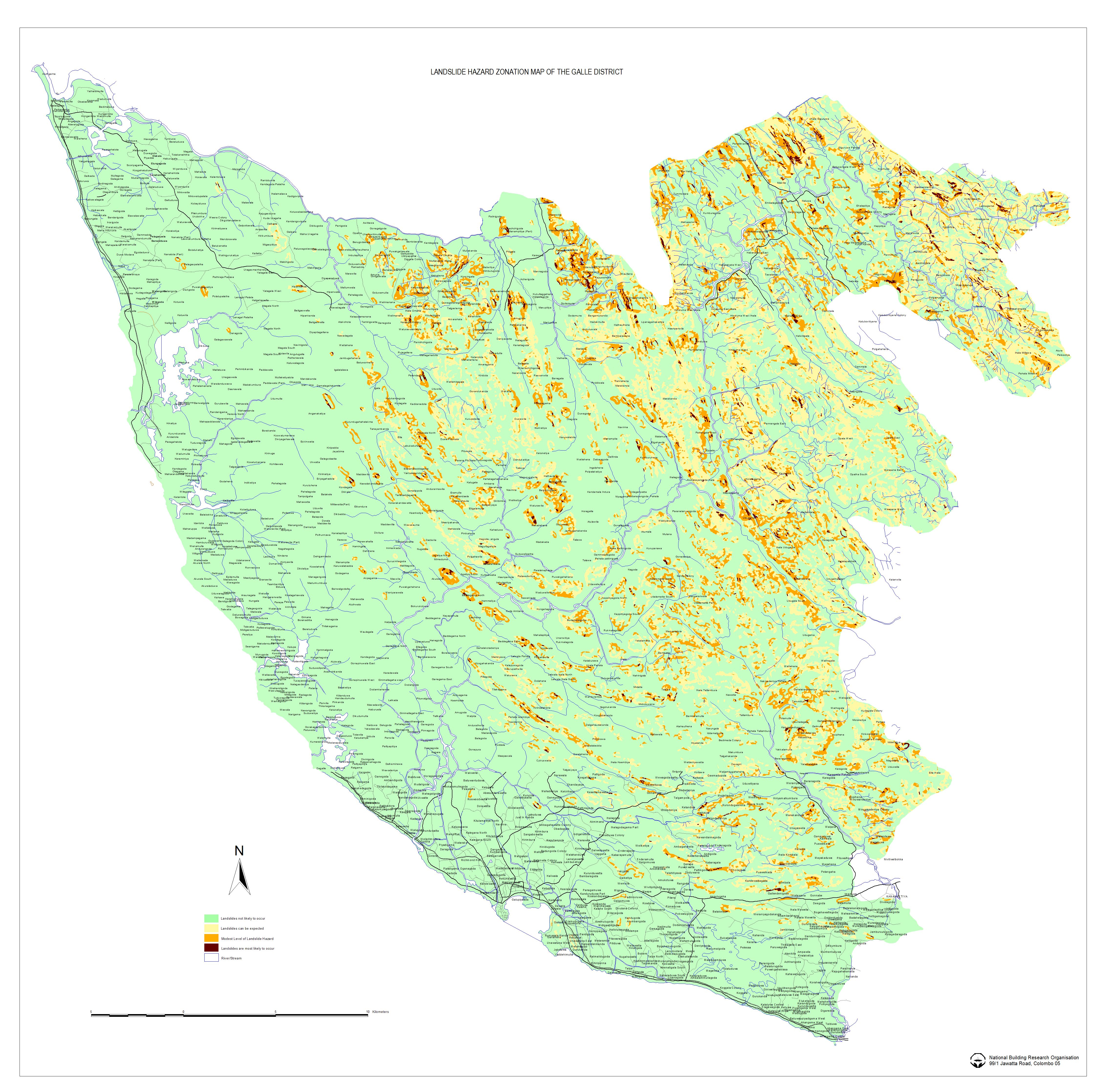
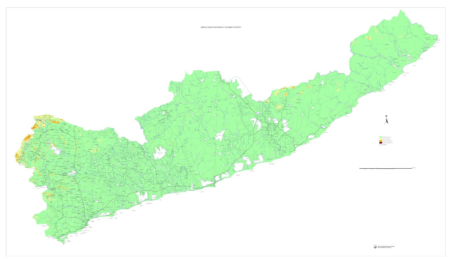
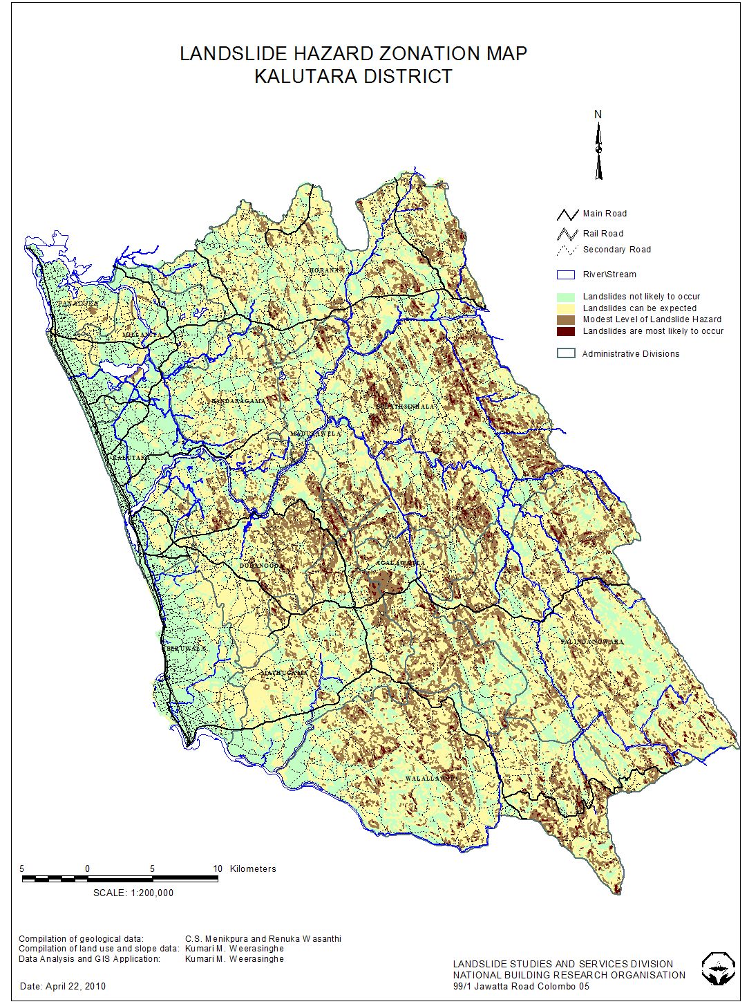


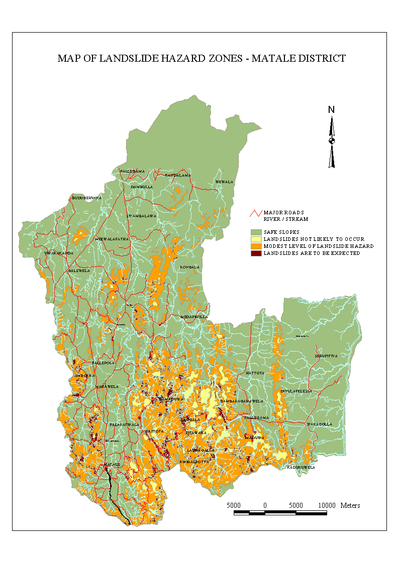

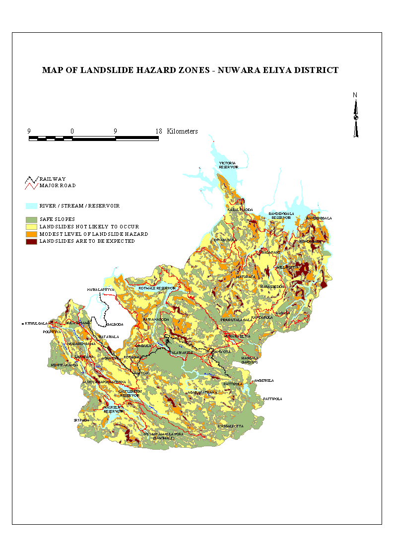
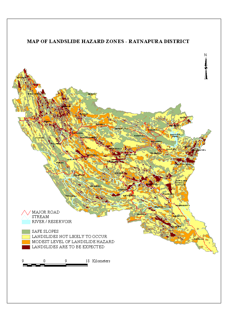
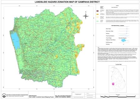
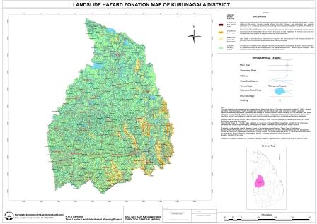


Landslide Research and Risk Management Division of NBRO has implemented a landslide hazard zonation mapping programme within the 10 landslide prone districts of Kalutara, Galle, Hambantota, Nuwara Eliya, Matale, Kandy, Kegalle, Ratnapura, Matara and Badulla. In addition to that the mapping has implemented within Monaragala, Gampaha and Kurunagala Districts also. The maps which display the distribution of the severity of landslide hazard potential in a given area, were intended to be used with associated guidelines as a decision making tool for development of central highlands of the country. It is also used for identification of elements at landslide risk and can be utilized in relocation, rehabilitation, allocation of relief funds and insurance purposes also. Mapping is carried out at 1:50000 scale and at 1:10000 scale.
1:50000 scale maps covering the entire districts of Kalutara, Galle, Hambantota, Nuwara Eliya, Matale, Kandy, Kegalle, Ratnapura, Matara, Badulla, Moneragala, Gampaha and Kurunegala are available for the use of planners, developers, decision makers, and general public.
Download 1:50000 scale maps
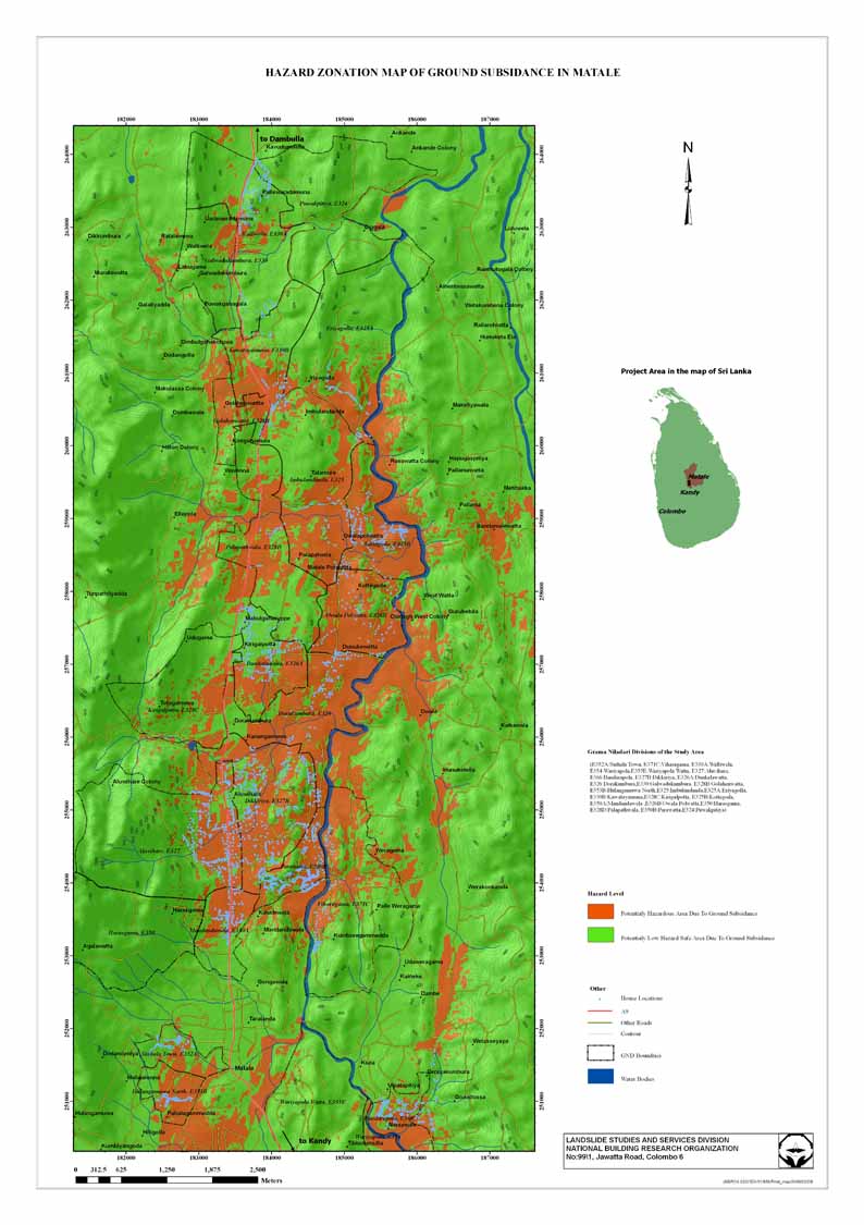
The methodology adopted for 1:10000 scale landslide hazard zonation mapping is based on an extensive field study and evaluation of six causative factor attributes and their sub factor elements and hence limited to the areas with potential to development and extremely high vulnerability to landslides (View a sample 1:10000 scale map). Availability of 1:10000 scale landslide hazard zonation maps.
| District | Area |
| Kandy | 480 |
| Hamban | 400 |
| Matara | 320 |
| Galle | 360 |
| Matale | 40 |
| Ratnapura | 1280 |
| Nuwara Eliya | 760 |
| Kalutara | 640 |
| Badulla | 1280 |
| Kegalle | 1120 |
| Matale | 40 |
Generation of maps for additional 320 sq.km of land area in Kurunagala District and additional 200 sq. km in Matale District are in progress and the maps are expected to be made available at the end of the year 2016.
Landslide hazard identification and assessment of landslide risk.
At the requests of various organisations, District and Divisional Secretaries, developers and individual owners, Landslide Research and Risk Management Division of NBRO carries out landslide potential identification and landslide risk evaluation investigations within various areas of the country and provides recommendations for minimizing any landslide risk.
Such landslide potential identifications and landslide risk evaluations are often requested by the government institutions who approve major development projects, rock quarries, and earth removals.
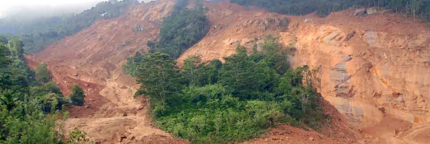
During the catastrophic events such as in October 2014 and May 2016 also, LRRMD immediately responded to the requests of the government for evaluating the landslide risk to the life and property of the affected areas and ensure the safety of the people.


")